
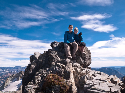
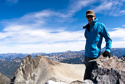
All smiles at the top of Mt. Daniel.
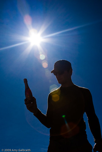
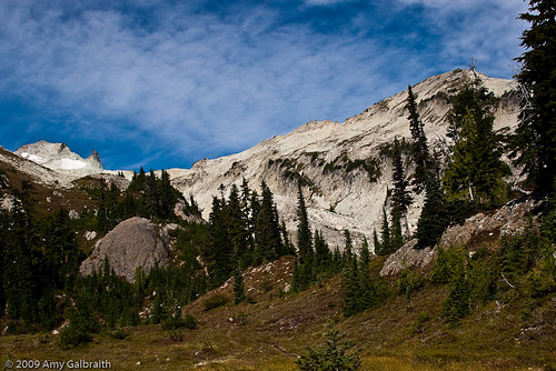
This week was one of the most challenging weeks I've had when it comes to backpacking. Not that I expected any less. I knew that summitting Mt. Daniel would be a challenge from the get-go. But it was our second attempt, and I had an idea of what to expect. We arrived at the Cathedral Rock trail head on September 14 around 11 am. This trail is kind of monotonous to me, considering we've hiked it several times now. It's just switchback after switchback. I was pretty excited when I finally saw the east summit of Mt. Daniel peaking through the trees on the trail to Peggy's Pond...WAY less snow! This was great. It was even better than I expected. After having to turn back due to early season snow last week, I was super stoked to see a nearly bare mountain. We set up camp, this time at the real Peggy's Pond, right next to the lake. It was still and quiet, and beautiful.
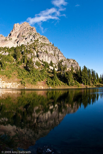
Peggy's Pond and Cathedral Rock. Mt. Daniel from our camp.
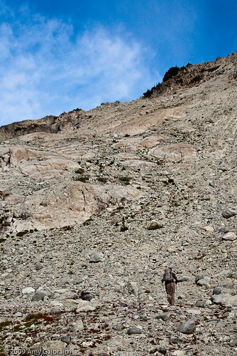
The next morning we woke up early, made breakfast, and hit the trail. The sky was clear and we had high hopes for the afternoon, hoping to be at the top of the west peak of Mt. Daniel within a few hours. The first part of the trail was easy, meandering through a rock-filled valley. An old, crusty snowfield lay at the other side. The second pitch of the trip would be a bit more challenging. The scree fields were slippery, and parts were really steep. It was hard to keep a good footing. Let's just say that David and I tried to climb next to each other instead of in a line. Rock falls were common. It took a bit of navigating to get to the top of that, but it wasn't too bad.
David on his way.
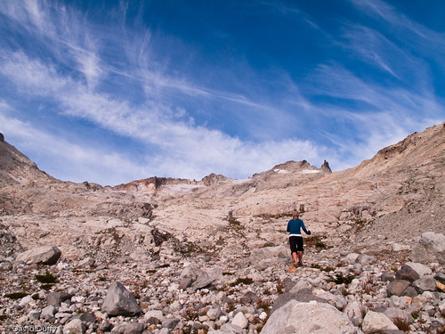
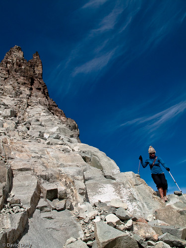
The goal is in sight.
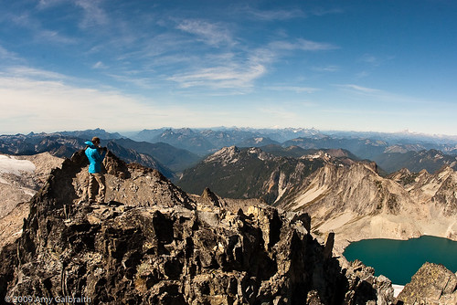
Before we knew it, we were staring up at the looming spire that lies right next to the east summit. It was frightening and majestic, really putting me in my place in the big world of nature. The last pitch was similar to the second, forcing us to climb and navigate through piles of rock. It was much easier this time though, as the rocks were bigger and more stable. The last part of the east summit was a little scramble which brought us to the very top. From there we could see the middle and west summit of Mt. Daniel -- our final destination. There was another guy at the top of the east summit who was on a much longer trip than us. He was also traveling solo -- not what I'd like to be doing on a mountain like this. We spent a few minutes oohing and aahing over the views of Mt. Rainier, Mt. Stuart, and even Mt. Adams. It was a very clear day.
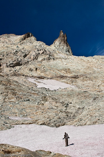
Feeling small.
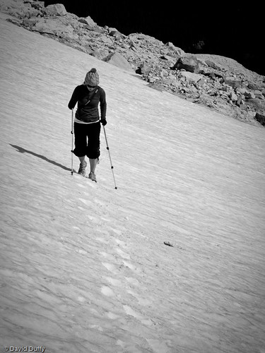
Snow traverse.
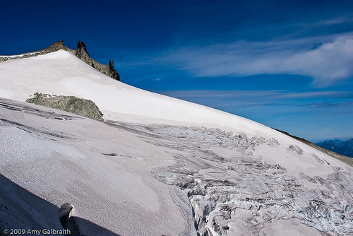
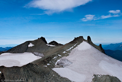
Daniel Glacier.
We left the east peak, trying to figure out a way to get to the very visible trail that led to the west summit. As I looked down one of the scree filled slopes, I decided that it would be a challenging, yet fine place to go down...wrong. This scree slope was not stable by any means. The rocks slipped with every step, and I was completely scared. We weren't on top of a cliff or anything, but the fact that I couldn't take one step without sliding at least two feet was unsettling. Luckily, David had more confidence than I and reached the trail, encouraging me the rest of the way down. I was left with only a couple of small scratches on my leg.
Coming down from east summit.
We followed the easy going trail all the way to the middle summit, passing a little rock wall where someone had slept in a bivy sack. We read the story on the Washington Trails Association website. It was just weird to be right next it. We continued on, only having to climb one last pitch of scree to reach the west summit -- the tallest point of Mt. Daniel. It was easy, considering I had visions of lunch dancing through my head...and another little treat.
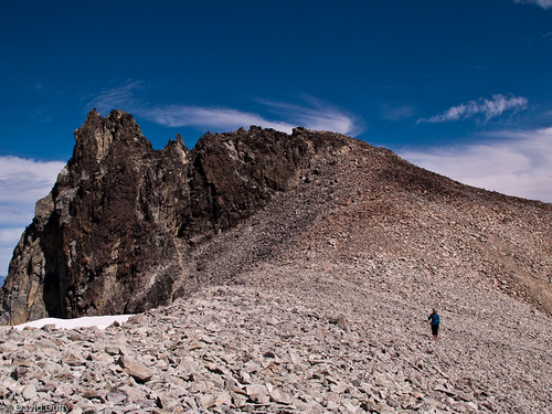
The west and middle summit of Mt. Daniel, respectively.
The easy trail to the west summit.
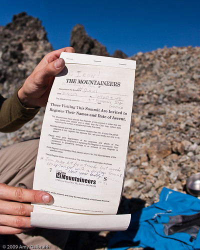
We reached the west summit around 1:15 p.m. David scrambled up the last little rocky outcrop and found the summit register. We signed our names, and looked out at the expansive views before us. We could see everything. Venus and Spade Lake, Mt. Stuart, Mt. Rainier, Bear's Breast, Mt. Adams, and even Mt. Baker. Below us was the mighty Lynch Glacier, draining into Pea Soup Lake below it. We were standing at nearly 8,000 feet and felt like we could see the whole world.
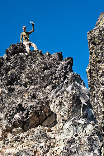
David finding the summit register.
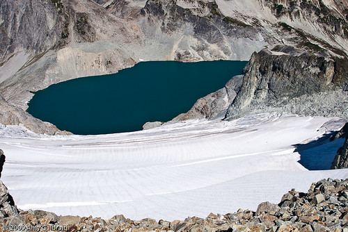
Lynch Glacier and Pea Soup Lake.
So excited.
At that point it was time to celebrate with the mini bottle of bubbly that David had carted all the way up the hill. It was the perfect ending to a long climb. That and freeze-dried mac & cheese. I'm sure that food would have tasted terrible at home but here, on top of the highest peak in King County, it was perfect.
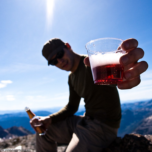
Cheers!
We shared our time at the top of the summit with another couple for a while, and then began the long trek down. We skipped the scary scree field, and somehow ended up on top of a snow field. At this point it was time for some glissading. Basically, skiing without skis! The first slope was quite a disaster. I ended up sliding on my butt the whole way down, slushy snow spraying up into my sunglasses, nearly crashing into the rocks below. The second slope was shallower, and I was able to stay on my feet but I got going pretty fast. No injuries :)
Me, being the navigator that I thought I was, decided that we should descend straight down into the valley. I thought I had seen a good way earlier in the day...really bad idea. We should have just gone the long way down the southeast ridge. We ended up above some cliffs, and had to traverse along a very slippery scree slope. It was nearly impossible to get a steady foot. I was terrified. Luckily, we made it across safely and David spotted a good way down to the bottom of the valley. Success!
We skipped across the last snow field, knowing the hard part was over. We could go back to camp and enjoy a big delicious dinner. The evening was so relaxing considering the long journey we had taken that day. I definitely tried somethings I'd never tried, and realized I am capable of a lot more than I give myself credit for. As I sit here typing this, I don't even want to stand up I'm so sore. Oh well, it was worth every step and I feel so accomplished. Depending on the weather, this could be our last trip of the summer. I'm okay with that though. It was the perfect ending to the best summer I've ever had.
No comments:
Post a Comment